44 locations found
MULTI FUNCTIONAL INDUSTRIAL PLATFORM "FLOREȘITI" #00041
#brownfield, #multifunctional-platform

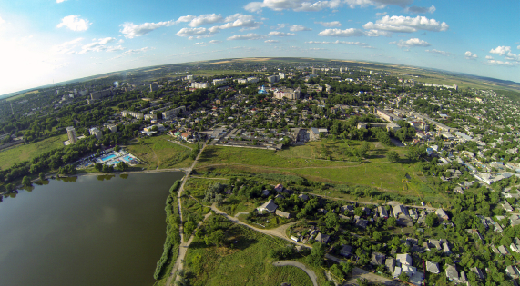
Soroca #00058
The Subzone Soroca consists of two delimited areas of a Brownfield and a Greenfield both located on the outskirts of the city on the ring road. The Brownfield represents an unfinished construction of a production building of ca 19,000 m² on a land plot of 3,02 hectares. It is connected to gas and electricity, having water and sewerage connection points in close proximity. The Brownfield is privately owned. The Greenfield, consisting of 2 land plots of 10 and 7.6 hectares, have immediate access to the National Road M2, ca 1 km away from the Brownfield. It is a public property of the mayoralty of Soroca.
#greenfield, #brownfield, #free-economic-zone

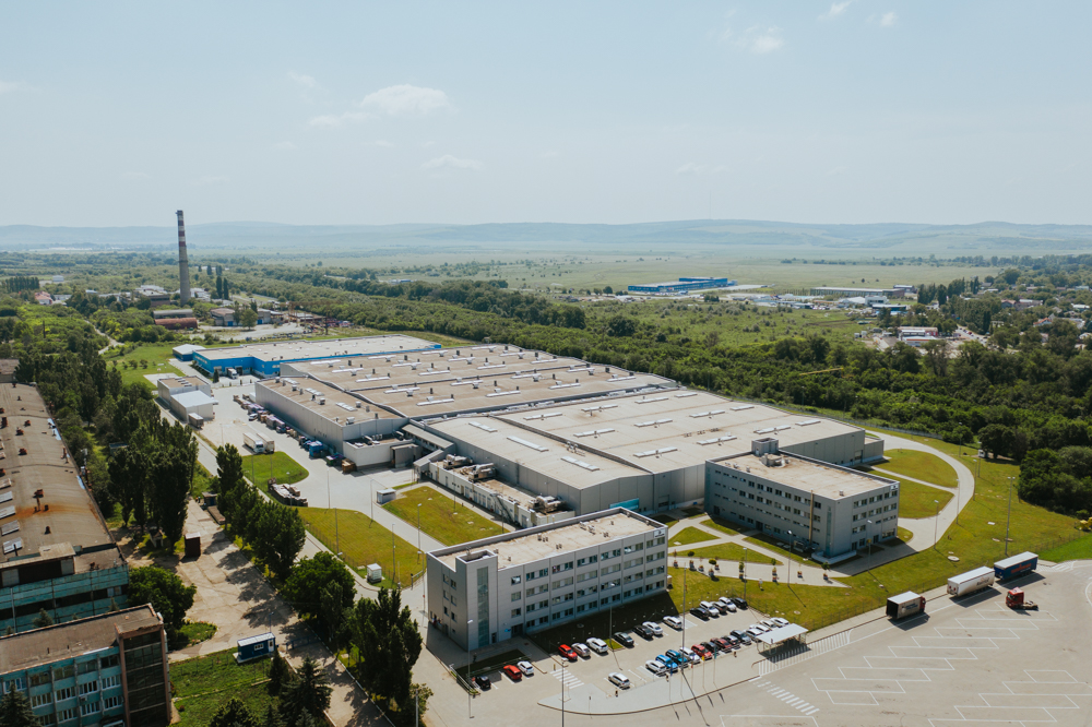
Strășeni #00069
Subzone Strășeni comprises four delimited areas of three brownfield and a greenfield located in the industrial zone of Strășeni Municipality. The Brownfields represent production and administrative buildings of the former plants. The total available area of the production premises within subzones is 55,000 sqm. The Brownfields are connected to utilities such as natural gas and electricity, having water and sewerage connection points in close proximity. The most important resident of subzone Strășeni is electric cable producer – La Triveneta Cavi Development. The Greenfield subzone is located in 600 m distance to the European route E58 and in immediate proximity to railway route Chisinau – Iași (ROU).
#brownfield, #free-economic-zone
| Location | Strășeni |
| Overall Population of the District | 92,400 inhabitants |
| Total Area of the City | 15 km² |
| Organizational Form | FEZ administration |
| Land Ownership | Private |
| Total Free Production Premises | 55,000 m2 |
| Free Buildable Area | 15 hectares |
FREE ECONOMIC ZONE "VALKANEȘ” #00022
FEZ “Valkaneș” is located in the proximity of 7 km to the East from the City center of Vulcănești. The FEZ has immediate connection to European road E584 connecting the cities of Poltava (UKR) and Galati (ROU). The subzone is delimited to the East along the railway route connecting Vulcănești with Chișniău and Black Sea port on Danube River. Out of the total area of the two subzones in Vulcănești (107 hectares), circa 20 hectares represents free buildable area on greenfield.
#brownfield, #greenfield, #free-economic-zone
FREE ECONOMIC ZONE “BĂLȚI”
Zone type: Greenfield
Location: Bălți
Overall Population of the District: 150,700 inhabitants
Total Area of the City: 78 km²
Organizational Form: FEZ administration
Land Ownership: Public
Free Buildable Area: 90 hectares
Multifunctional Platform "Briceni"
Zone type: Brownfield
Zone population: 123.456 people

Comrat
Zone type: Greenfield
Location: Comrat Municipality
Overall Population of the Autonomy: 150,000 inhabitants
Total Area of the City: 17 km²
Organizational Form: FEZ administration
Land Ownership: Public
Free Buildable Area: 40 hectares

Hîncești
Zone type: Brownfield
Location: Hîncești
Overall Population of the District: 119,200 Inhabitants
Total Area of the City: 1.484 km²
Organizational Form: FEZ administration
Land Ownership: Private
Land Area: 1.99 hectares
INDUSTRIAL PARK "EDINEȚ"
Zone type: Brownfield
Location: Edinet
Overall population of the District: 79,200 inhabitants
Total area of the city: 5.7 km2
Organization Form: IP administration
Land Ownership: Public
Free Buildable Area: 5 hectares
MULTI FUNCTIONAL INDUSTRIAL PLATFORM "ANENII NOI"
Zone type: Brownfield

Nisporeni
Zone type: Greenfield
Location: Nisporeni
Overall Population of the District: 65,400 Inhabitants
Total Area of the City: 14 km²
Organizational Form: FEZ administration
Land Ownership: Private
Land Area: 23.7 hectares

Ceadir-Lunga
Zone type: Greenfield
Location: Ceadîr-Lunga
Overall Population of the Autonomy: 150.000 Inhabitants
Total Area of the City: 9.6 km2
Organizational Form: FEZ administration
Land Ownership: Public
Land Area: 42 hectares

Căușeni
Zone type: Greenfield
Location: Căușeni
Overall Population of the District: 90,500 inhabitants
Total Area of the City: 10 km²
Organizational Form: FEZ administration
Land Ownership: Private \/ Public
Free Buildable Area: 5.5 hectares

FREE ECONOMIC ZONE "UNGHENI-BUSINESS”
Zone type: Brownfield
Location: Ungheni
Overall Population of District: 117,100 Inhabitants
Total Area of the City: 16.4 km2
Organizational Form: FEZ administration
Land Ownership: Private
Free Buildable area: 5.15 hectares
Subzones
MULTI FUNCTIONAL INDUSTRIAL PLATFORM "CANTEMIR"
Zone type: Brownfield

Tuzara (Călărași)
Zone type: Greenfield
Location: Tuzara (Călărași)
Overall Population of the District: 77,300 Inhabitants
Total Area of the City: 42.33 km²
Organizational Form: FEZ administration
Land Ownership: Public
Land Area: 32.27 hectares

Orhei
Zone type: Brownfield
Location: Orhei
Overall Population of the District: 25,000 inhabitants
Total Area of the City: 8,5 km²
Organizational Form: FEZ administration
Land Ownership: Public
Free Buildable Area: 8 hectares, with possibility to extend up to 170 hectares
FREE ECONOMIC ZONE "EXPO BUSINESS CHIȘINĂU”
Zone type: Brownfield
Subzones
MULTI FUNCTIONAL INDUSTRIAL PLATFORM "FLOREȘITI"
Zone type: Brownfield
Soroca
Zone type: Greenfield
Location: Soroca
Overall Population of the District: 100,000 Inhabitants
Total Area of the City: 11.88 km2
Organizational Form: FEZ administration
Land Ownership: Public
Total Free Buildable Area: 17.6 hectares
Strășeni
Zone type: Brownfield
Location: Strășeni
Overall Population of the District: 92,400 inhabitants
Total Area of the City: 15 km²
Organizational Form: FEZ administration
Land Ownership: Private
Total Free Production Premises: 55,000 m2
Free Buildable Area: 15 hectares
FREE ECONOMIC ZONE "VALKANEȘ”
Zone type: Brownfield
Subzones
MULTI FUNCTIONAL INDUSTRIAL PLATFORM "IALOVENI"
Zone type: Brownfield
MULTI FUNCTIONAL INDUSTRIAL PLATFORM "LEOVA"
Zone type: Brownfield
MULTI FUNCTIONAL INDUSTRIAL PLATFORM "OCNIȚA"
Zone type: Brownfield

FREE ECONOMIC ZONE "Taraclia”
Zone type: Greenfield
Location: Taraclia
Overall Population of District: 43,000 inhabitants
Total Area of the City: 34 km²
Organizational Form: FEZ administration
Land Ownership: Public
Free Buildable Area: 33 hectares
MULTI FUNCTIONAL INDUSTRIAL PLATFORM "RÎȘCANI"
Zone type: Brownfield
MULTI FUNCTIONAL INDUSTRIAL PLATFORM "SÎNGEREI"
Zone type: Brownfield

MULTI FUNCTIONAL INDUSTRIAL PLATFORM "ȘOLDĂNEȘTI"
Zone type: Brownfield
MULTI FUNCTIONAL INDUSTRIAL PLATFORM "TELENEȘTI"
Zone type: Brownfield
MULTI FUNCTIONAL INDUSTRIAL PLATFORM "BASARABEASCA"
Zone type: Brownfield

MULTI FUNCTIONAL INDUSTRIAL PLATFORM "GLODENI"
Zone type: Brownfield
Multifunctional Platform "Ceadîr Lunga"
Zone type: Brownfield

