44 locations found
MULTI FUNCTIONAL INDUSTRIAL PLATFORM "CANTEMIR" #00040
#brownfield, #multifunctional-platform

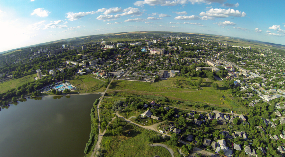
Tuzara (Călărași) #00057
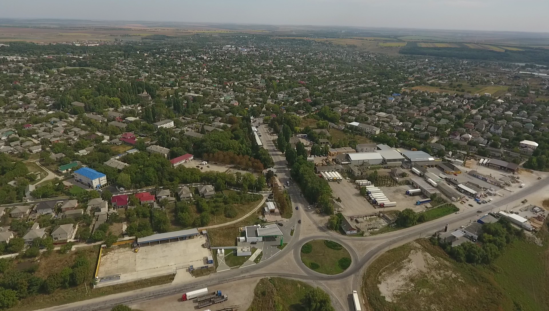
The City of Călărași is the administrative centre of Călărași District located in the central part of the Republic of Moldova at 55 km proximity to the capital city Chișinău. The City of Călărași has a population of 16.2 thousand inhabitants. Călărași District consists of 43 localities and a capital city with the total population of 77.3 thousand inhabitants. The main branches of the district economy are manufacturing and agriculture. The city hosts apparel and footwear manufacturing enterprises, wood articles, plastic pipes and construction materials producers. The agro-industrial sector is represented by areas such as wine-making, canned food, dairy, farming and fruit and vegetables growing. Călărași District is also an attractive touristic destination due to forests surroundings and landscapes, its monasteries, wineries and sanatorium “Codru”. Călărași lies on the important railway route and International E-road E58 connecting the Commonwealth of Independent States and the European Union, which Moldova signed free trade agreements with.
#greenfield, #free-economic-zone
| Location | Tuzara (Călărași) |
| Overall Population of the District | 77,300 Inhabitants |
| Total Area of the City | 42.33 km² |
| Organizational Form | FEZ administration |
| Land Ownership | Public |
| Land Area | 32.27 hectares |

Orhei #00068
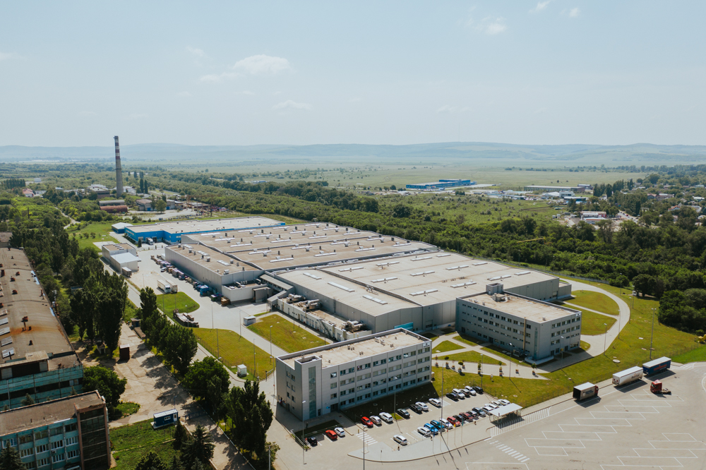
Subzone Orhei is located in a distance of 2 km from the Orhei City center along the national magistral road M2 connecting cities: Chisinau (MDL) and Vinnita (UKR). The land plot size is 8 hectares with possibility to extend up to 170 hectares. The only resident of the subzone is a manufacturer of wiring harness for automotive industry – SEBN Sumitomo Electric Bordnetze.
#brownfield, #free-economic-zone
| Location | Orhei |
| Overall Population of the District | 25,000 inhabitants |
| Total Area of the City | 8,5 km² |
| Organizational Form | FEZ administration |
| Land Ownership | Public |
| Free Buildable Area | 8 hectares, with possibility to extend up to 170 hectares |
FREE ECONOMIC ZONE "EXPO BUSINESS CHIȘINĂU” #00020
#brownfield, #free-economic-zone
FREE ECONOMIC ZONE “BĂLȚI”
Zone type: Greenfield
Location: Bălți
Overall Population of the District: 150,700 inhabitants
Total Area of the City: 78 km²
Organizational Form: FEZ administration
Land Ownership: Public
Free Buildable Area: 90 hectares
Multifunctional Platform "Briceni"
Zone type: Brownfield
Zone population: 123.456 people

Comrat
Zone type: Greenfield
Location: Comrat Municipality
Overall Population of the Autonomy: 150,000 inhabitants
Total Area of the City: 17 km²
Organizational Form: FEZ administration
Land Ownership: Public
Free Buildable Area: 40 hectares

Hîncești
Zone type: Brownfield
Location: Hîncești
Overall Population of the District: 119,200 Inhabitants
Total Area of the City: 1.484 km²
Organizational Form: FEZ administration
Land Ownership: Private
Land Area: 1.99 hectares
INDUSTRIAL PARK "EDINEȚ"
Zone type: Brownfield
Location: Edinet
Overall population of the District: 79,200 inhabitants
Total area of the city: 5.7 km2
Organization Form: IP administration
Land Ownership: Public
Free Buildable Area: 5 hectares
MULTI FUNCTIONAL INDUSTRIAL PLATFORM "ANENII NOI"
Zone type: Brownfield

Nisporeni
Zone type: Greenfield
Location: Nisporeni
Overall Population of the District: 65,400 Inhabitants
Total Area of the City: 14 km²
Organizational Form: FEZ administration
Land Ownership: Private
Land Area: 23.7 hectares

Ceadir-Lunga
Zone type: Greenfield
Location: Ceadîr-Lunga
Overall Population of the Autonomy: 150.000 Inhabitants
Total Area of the City: 9.6 km2
Organizational Form: FEZ administration
Land Ownership: Public
Land Area: 42 hectares

Căușeni
Zone type: Greenfield
Location: Căușeni
Overall Population of the District: 90,500 inhabitants
Total Area of the City: 10 km²
Organizational Form: FEZ administration
Land Ownership: Private \/ Public
Free Buildable Area: 5.5 hectares

FREE ECONOMIC ZONE "UNGHENI-BUSINESS”
Zone type: Brownfield
Location: Ungheni
Overall Population of District: 117,100 Inhabitants
Total Area of the City: 16.4 km2
Organizational Form: FEZ administration
Land Ownership: Private
Free Buildable area: 5.15 hectares
Subzones
MULTI FUNCTIONAL INDUSTRIAL PLATFORM "CANTEMIR"
Zone type: Brownfield
Tuzara (Călărași)
Zone type: Greenfield
Location: Tuzara (Călărași)
Overall Population of the District: 77,300 Inhabitants
Total Area of the City: 42.33 km²
Organizational Form: FEZ administration
Land Ownership: Public
Land Area: 32.27 hectares
Orhei
Zone type: Brownfield
Location: Orhei
Overall Population of the District: 25,000 inhabitants
Total Area of the City: 8,5 km²
Organizational Form: FEZ administration
Land Ownership: Public
Free Buildable Area: 8 hectares, with possibility to extend up to 170 hectares
FREE ECONOMIC ZONE "EXPO BUSINESS CHIȘINĂU”
Zone type: Brownfield
Subzones
MULTI FUNCTIONAL INDUSTRIAL PLATFORM "FLOREȘITI"
Zone type: Brownfield

Soroca
Zone type: Greenfield
Location: Soroca
Overall Population of the District: 100,000 Inhabitants
Total Area of the City: 11.88 km2
Organizational Form: FEZ administration
Land Ownership: Public
Total Free Buildable Area: 17.6 hectares

Strășeni
Zone type: Brownfield
Location: Strășeni
Overall Population of the District: 92,400 inhabitants
Total Area of the City: 15 km²
Organizational Form: FEZ administration
Land Ownership: Private
Total Free Production Premises: 55,000 m2
Free Buildable Area: 15 hectares
FREE ECONOMIC ZONE "VALKANEȘ”
Zone type: Brownfield
Subzones
MULTI FUNCTIONAL INDUSTRIAL PLATFORM "IALOVENI"
Zone type: Brownfield
MULTI FUNCTIONAL INDUSTRIAL PLATFORM "LEOVA"
Zone type: Brownfield
MULTI FUNCTIONAL INDUSTRIAL PLATFORM "OCNIȚA"
Zone type: Brownfield

FREE ECONOMIC ZONE "Taraclia”
Zone type: Greenfield
Location: Taraclia
Overall Population of District: 43,000 inhabitants
Total Area of the City: 34 km²
Organizational Form: FEZ administration
Land Ownership: Public
Free Buildable Area: 33 hectares
MULTI FUNCTIONAL INDUSTRIAL PLATFORM "RÎȘCANI"
Zone type: Brownfield
MULTI FUNCTIONAL INDUSTRIAL PLATFORM "SÎNGEREI"
Zone type: Brownfield

MULTI FUNCTIONAL INDUSTRIAL PLATFORM "ȘOLDĂNEȘTI"
Zone type: Brownfield
MULTI FUNCTIONAL INDUSTRIAL PLATFORM "TELENEȘTI"
Zone type: Brownfield
MULTI FUNCTIONAL INDUSTRIAL PLATFORM "BASARABEASCA"
Zone type: Brownfield

MULTI FUNCTIONAL INDUSTRIAL PLATFORM "GLODENI"
Zone type: Brownfield
Multifunctional Platform "Ceadîr Lunga"
Zone type: Brownfield

