44 locations found

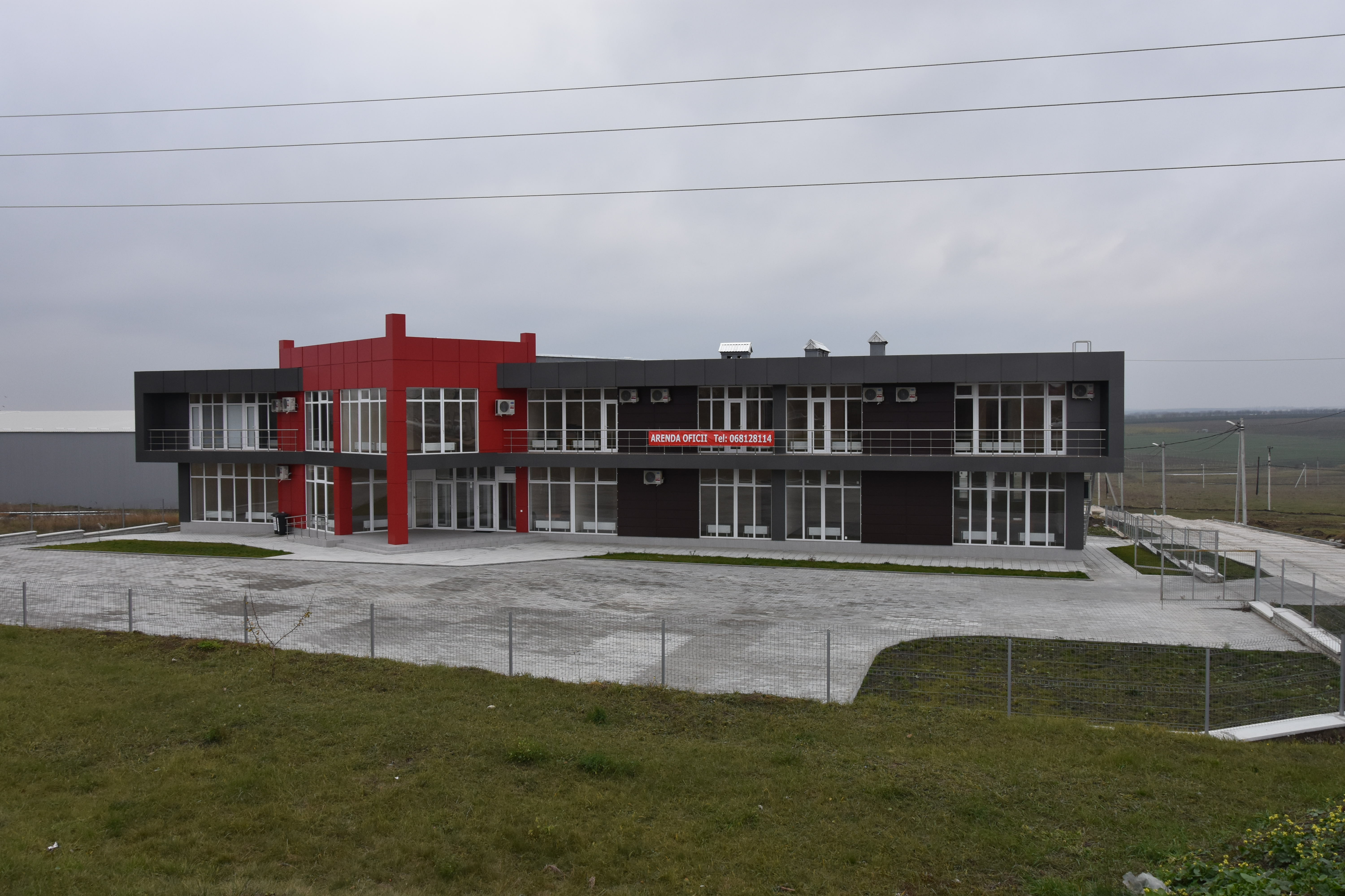
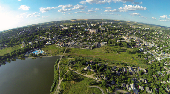
Hîncești #00064
Hîncești subzone is situated in the eastern part of the city on the territory of 2 hectares.The subzone represents a newly constructed buildings of circa 12,000 m² for production purposes. The constructions are in private ownership. The subzone has immediate connection to European route E584 providing connections to the capital city Chisinau (44 km to the south) and border crossing point with Romania (46 km to the west).
#brownfield, #free-economic-zone
| Location | Hîncești |
| Overall Population of the District | 119,200 Inhabitants |
| Total Area of the City | 1.484 km² |
| Organizational Form | FEZ administration |
| Land Ownership | Private |
| Land Area | 1.99 hectares |
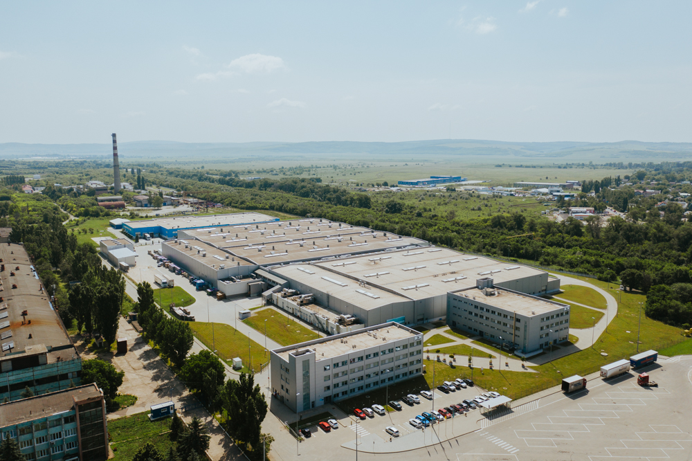
INDUSTRIAL PARK "EDINEȚ" #00003
Edineț Municipality is the administrative center of Edineț District located in the northern part of the Republic of Moldova. Edineț District comprises 49 rural localities with the total population of 79.2 thousand inhabitants. Edineț Municipality alone has a population of 18.4 thousand inhabitants. The main economic activities of the District are manufacturing and agriculture. The different types of manufacturing that predominate are cable assemblies for automotive industry and light industry. The agri-food sector is represented by areas such as canned food juice concentrate, dairy, bakery products, and other industries based on local raw materials.
#brownfield, #industrial-park
| Location | Edinet |
| Overall population of the District | 79,200 inhabitants |
| Total area of the city | 5.7 km2 |
| Organization Form | IP administration |
| Land Ownership | Public |
| Free Buildable Area | 5 hectares |
FREE ECONOMIC ZONE "OTACI-BUSINESS” #00006
Free Economic Zone Otaci is located in 2 km distance to the City center of Otaci and ca 3 km to the junction of 3 national roads: R9 (connecting the cities of Soroca - Arionesti - Moghilev-Podolskii – border checkpoint with Ukraine), R51 (connecting the cities Otaci – Ocnita) and R8 (connecting the cities of Otaci and Edinet), wich is also E583 (connecting Romania with Ukraine).
#brownfield, #free-economic-zone
MULTI FUNCTIONAL INDUSTRIAL PLATFORM "ANENII NOI" #00039
#brownfield, #multifunctional-platform
FREE ECONOMIC ZONE “BĂLȚI”
Zone type: Greenfield
Location: Bălți
Overall Population of the District: 150,700 inhabitants
Total Area of the City: 78 km²
Organizational Form: FEZ administration
Land Ownership: Public
Free Buildable Area: 90 hectares
Multifunctional Platform "Briceni"
Zone type: Brownfield
Zone population: 123.456 people

Comrat
Zone type: Greenfield
Location: Comrat Municipality
Overall Population of the Autonomy: 150,000 inhabitants
Total Area of the City: 17 km²
Organizational Form: FEZ administration
Land Ownership: Public
Free Buildable Area: 40 hectares
Hîncești
Zone type: Brownfield
Location: Hîncești
Overall Population of the District: 119,200 Inhabitants
Total Area of the City: 1.484 km²
Organizational Form: FEZ administration
Land Ownership: Private
Land Area: 1.99 hectares
INDUSTRIAL PARK "EDINEȚ"
Zone type: Brownfield
Location: Edinet
Overall population of the District: 79,200 inhabitants
Total area of the city: 5.7 km2
Organization Form: IP administration
Land Ownership: Public
Free Buildable Area: 5 hectares
MULTI FUNCTIONAL INDUSTRIAL PLATFORM "ANENII NOI"
Zone type: Brownfield

Nisporeni
Zone type: Greenfield
Location: Nisporeni
Overall Population of the District: 65,400 Inhabitants
Total Area of the City: 14 km²
Organizational Form: FEZ administration
Land Ownership: Private
Land Area: 23.7 hectares

Ceadir-Lunga
Zone type: Greenfield
Location: Ceadîr-Lunga
Overall Population of the Autonomy: 150.000 Inhabitants
Total Area of the City: 9.6 km2
Organizational Form: FEZ administration
Land Ownership: Public
Land Area: 42 hectares

Căușeni
Zone type: Greenfield
Location: Căușeni
Overall Population of the District: 90,500 inhabitants
Total Area of the City: 10 km²
Organizational Form: FEZ administration
Land Ownership: Private \/ Public
Free Buildable Area: 5.5 hectares

FREE ECONOMIC ZONE "UNGHENI-BUSINESS”
Zone type: Brownfield
Location: Ungheni
Overall Population of District: 117,100 Inhabitants
Total Area of the City: 16.4 km2
Organizational Form: FEZ administration
Land Ownership: Private
Free Buildable area: 5.15 hectares
Subzones
MULTI FUNCTIONAL INDUSTRIAL PLATFORM "CANTEMIR"
Zone type: Brownfield

Tuzara (Călărași)
Zone type: Greenfield
Location: Tuzara (Călărași)
Overall Population of the District: 77,300 Inhabitants
Total Area of the City: 42.33 km²
Organizational Form: FEZ administration
Land Ownership: Public
Land Area: 32.27 hectares

Orhei
Zone type: Brownfield
Location: Orhei
Overall Population of the District: 25,000 inhabitants
Total Area of the City: 8,5 km²
Organizational Form: FEZ administration
Land Ownership: Public
Free Buildable Area: 8 hectares, with possibility to extend up to 170 hectares
FREE ECONOMIC ZONE "EXPO BUSINESS CHIȘINĂU”
Zone type: Brownfield
Subzones
MULTI FUNCTIONAL INDUSTRIAL PLATFORM "FLOREȘITI"
Zone type: Brownfield

Soroca
Zone type: Greenfield
Location: Soroca
Overall Population of the District: 100,000 Inhabitants
Total Area of the City: 11.88 km2
Organizational Form: FEZ administration
Land Ownership: Public
Total Free Buildable Area: 17.6 hectares

Strășeni
Zone type: Brownfield
Location: Strășeni
Overall Population of the District: 92,400 inhabitants
Total Area of the City: 15 km²
Organizational Form: FEZ administration
Land Ownership: Private
Total Free Production Premises: 55,000 m2
Free Buildable Area: 15 hectares
FREE ECONOMIC ZONE "VALKANEȘ”
Zone type: Brownfield
Subzones
MULTI FUNCTIONAL INDUSTRIAL PLATFORM "IALOVENI"
Zone type: Brownfield
MULTI FUNCTIONAL INDUSTRIAL PLATFORM "LEOVA"
Zone type: Brownfield
MULTI FUNCTIONAL INDUSTRIAL PLATFORM "OCNIȚA"
Zone type: Brownfield

FREE ECONOMIC ZONE "Taraclia”
Zone type: Greenfield
Location: Taraclia
Overall Population of District: 43,000 inhabitants
Total Area of the City: 34 km²
Organizational Form: FEZ administration
Land Ownership: Public
Free Buildable Area: 33 hectares
MULTI FUNCTIONAL INDUSTRIAL PLATFORM "RÎȘCANI"
Zone type: Brownfield
MULTI FUNCTIONAL INDUSTRIAL PLATFORM "SÎNGEREI"
Zone type: Brownfield

MULTI FUNCTIONAL INDUSTRIAL PLATFORM "ȘOLDĂNEȘTI"
Zone type: Brownfield
MULTI FUNCTIONAL INDUSTRIAL PLATFORM "TELENEȘTI"
Zone type: Brownfield
MULTI FUNCTIONAL INDUSTRIAL PLATFORM "BASARABEASCA"
Zone type: Brownfield

MULTI FUNCTIONAL INDUSTRIAL PLATFORM "GLODENI"
Zone type: Brownfield
Multifunctional Platform "Ceadîr Lunga"
Zone type: Brownfield

