44 locations found

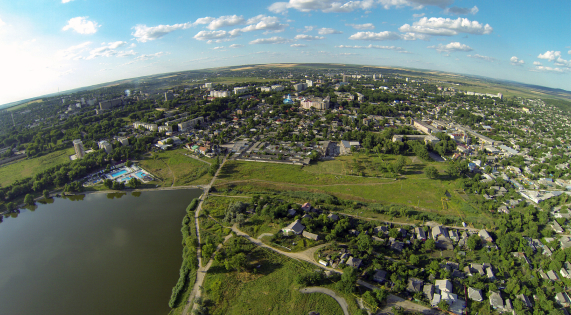
Nisporeni #00063
Subzone Nisporeni consists of two delimited areas of a Brownfield and a Greenfield. The Brownfield of 2.4 hectares represents the existing constructions of a former agricultural machinery service center. The Greenfield of 23.7 hectares lies on the southern outskirts of the City of Nisporeni. It is situated in close proximity to the utility lines such as electricity, water, sewerage, and gas. The land plot is in private ownership and available for rent or sale. Both areas have good connection to the National road R25, which connects Nisporeni with the capital City of Chișinău (73 km east) and the border crossing point with Romania (67 km north).
#greenfield, #free-economic-zone
| Location | Nisporeni |
| Overall Population of the District | 65,400 Inhabitants |
| Total Area of the City | 14 km² |
| Organizational Form | FEZ administration |
| Land Ownership | Private |
| Land Area | 23.7 hectares |

Ceadir-Lunga #00065
The Subzone Ceadîr-Lunga is located in the northern part of Ceadîr-Lunga Municipality in the proximity of 3 km from the city center. The Greenfield of 42 hectares is situated in immediate proximity to the existing industrial zone of the Municipality. The Subzone has access to the National Roads R36 (Basarabeasca – Ceadîr-Lunga – Taraclia) and R37 (Ceadîr-Lunga – Comrat – Cantemir), and the railway route connecting the Municipality with Basarabeasca (railway customs crossing point with Ukraine) and the Black See port on Danube River.
#greenfield, #free-economic-zone
| Location | Ceadîr-Lunga |
| Overall Population of the Autonomy | 150.000 Inhabitants |
| Total Area of the City | 9.6 km2 |
| Organizational Form | FEZ administration |
| Land Ownership | Public |
| Land Area | 42 hectares |

Căușeni #00070
The Subzone Căușeni is located in 1.5 km proximity to the city center. The Subzone’s land plot of 8. 5 hectares has good access to two National Roads R26 and R30 connecting the District with capital city Chișinău (up north) and the border checkpoint with Ukraine (down south). The most important resident of the Subzone is a cable assemblies and injection moulded components producer – Coroplast Harness Technologies, who is currently constructing its own plant on the area of 3 hectares of the Subzone.
#greenfield, #free-economic-zone
| Location | Căușeni |
| Overall Population of the District | 90,500 inhabitants |
| Total Area of the City | 10 km² |
| Organizational Form | FEZ administration |
| Land Ownership | Private \/ Public |
| Free Buildable Area | 5.5 hectares |

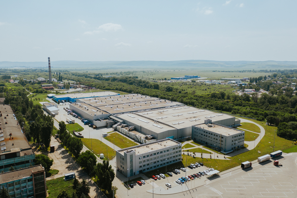
FREE ECONOMIC ZONE "UNGHENI-BUSINESS” #00016
FEZ “Ungheni-Business” was created in 2002 for a 42-year period. The FEZ is located in the north-western part of the city, within the industrial area. The zone consists 12 subzones with a total area of 145.2 hectares in two Development Regions of the Republic of Moldova (Center and North), namely in Ungheni Municipality (4 subzones – 49,57 hectares), Ungheni District, Zagarancea village (2 subzones – 14,60 ha) Soroca Municipality (2 subzones – 20.62 ha), Hîncești Municipality (1.99 ha), the City of Nisporeni (2 subzones – 26.11 ha), and the Călărași City,Tuzara village (32.27 ha)
#brownfield, #free-economic-zone
| Location | Ungheni |
| Overall Population of District | 117,100 Inhabitants |
| Total Area of the City | 16.4 km2 |
| Organizational Form | FEZ administration |
| Land Ownership | Private |
| Free Buildable area | 5.15 hectares |
FREE ECONOMIC ZONE “BĂLȚI”
Zone type: Greenfield
Location: Bălți
Overall Population of the District: 150,700 inhabitants
Total Area of the City: 78 km²
Organizational Form: FEZ administration
Land Ownership: Public
Free Buildable Area: 90 hectares
Multifunctional Platform "Briceni"
Zone type: Brownfield
Zone population: 123.456 people

Comrat
Zone type: Greenfield
Location: Comrat Municipality
Overall Population of the Autonomy: 150,000 inhabitants
Total Area of the City: 17 km²
Organizational Form: FEZ administration
Land Ownership: Public
Free Buildable Area: 40 hectares

Hîncești
Zone type: Brownfield
Location: Hîncești
Overall Population of the District: 119,200 Inhabitants
Total Area of the City: 1.484 km²
Organizational Form: FEZ administration
Land Ownership: Private
Land Area: 1.99 hectares
INDUSTRIAL PARK "EDINEȚ"
Zone type: Brownfield
Location: Edinet
Overall population of the District: 79,200 inhabitants
Total area of the city: 5.7 km2
Organization Form: IP administration
Land Ownership: Public
Free Buildable Area: 5 hectares
MULTI FUNCTIONAL INDUSTRIAL PLATFORM "ANENII NOI"
Zone type: Brownfield
Nisporeni
Zone type: Greenfield
Location: Nisporeni
Overall Population of the District: 65,400 Inhabitants
Total Area of the City: 14 km²
Organizational Form: FEZ administration
Land Ownership: Private
Land Area: 23.7 hectares
Ceadir-Lunga
Zone type: Greenfield
Location: Ceadîr-Lunga
Overall Population of the Autonomy: 150.000 Inhabitants
Total Area of the City: 9.6 km2
Organizational Form: FEZ administration
Land Ownership: Public
Land Area: 42 hectares
Căușeni
Zone type: Greenfield
Location: Căușeni
Overall Population of the District: 90,500 inhabitants
Total Area of the City: 10 km²
Organizational Form: FEZ administration
Land Ownership: Private \/ Public
Free Buildable Area: 5.5 hectares
FREE ECONOMIC ZONE "UNGHENI-BUSINESS”
Zone type: Brownfield
Location: Ungheni
Overall Population of District: 117,100 Inhabitants
Total Area of the City: 16.4 km2
Organizational Form: FEZ administration
Land Ownership: Private
Free Buildable area: 5.15 hectares
Subzones
MULTI FUNCTIONAL INDUSTRIAL PLATFORM "CANTEMIR"
Zone type: Brownfield

Tuzara (Călărași)
Zone type: Greenfield
Location: Tuzara (Călărași)
Overall Population of the District: 77,300 Inhabitants
Total Area of the City: 42.33 km²
Organizational Form: FEZ administration
Land Ownership: Public
Land Area: 32.27 hectares

Orhei
Zone type: Brownfield
Location: Orhei
Overall Population of the District: 25,000 inhabitants
Total Area of the City: 8,5 km²
Organizational Form: FEZ administration
Land Ownership: Public
Free Buildable Area: 8 hectares, with possibility to extend up to 170 hectares
FREE ECONOMIC ZONE "EXPO BUSINESS CHIȘINĂU”
Zone type: Brownfield
Subzones
MULTI FUNCTIONAL INDUSTRIAL PLATFORM "FLOREȘITI"
Zone type: Brownfield

Soroca
Zone type: Greenfield
Location: Soroca
Overall Population of the District: 100,000 Inhabitants
Total Area of the City: 11.88 km2
Organizational Form: FEZ administration
Land Ownership: Public
Total Free Buildable Area: 17.6 hectares

Strășeni
Zone type: Brownfield
Location: Strășeni
Overall Population of the District: 92,400 inhabitants
Total Area of the City: 15 km²
Organizational Form: FEZ administration
Land Ownership: Private
Total Free Production Premises: 55,000 m2
Free Buildable Area: 15 hectares
FREE ECONOMIC ZONE "VALKANEȘ”
Zone type: Brownfield
Subzones
MULTI FUNCTIONAL INDUSTRIAL PLATFORM "IALOVENI"
Zone type: Brownfield
MULTI FUNCTIONAL INDUSTRIAL PLATFORM "LEOVA"
Zone type: Brownfield
MULTI FUNCTIONAL INDUSTRIAL PLATFORM "OCNIȚA"
Zone type: Brownfield

FREE ECONOMIC ZONE "Taraclia”
Zone type: Greenfield
Location: Taraclia
Overall Population of District: 43,000 inhabitants
Total Area of the City: 34 km²
Organizational Form: FEZ administration
Land Ownership: Public
Free Buildable Area: 33 hectares
MULTI FUNCTIONAL INDUSTRIAL PLATFORM "RÎȘCANI"
Zone type: Brownfield
MULTI FUNCTIONAL INDUSTRIAL PLATFORM "SÎNGEREI"
Zone type: Brownfield

MULTI FUNCTIONAL INDUSTRIAL PLATFORM "ȘOLDĂNEȘTI"
Zone type: Brownfield
MULTI FUNCTIONAL INDUSTRIAL PLATFORM "TELENEȘTI"
Zone type: Brownfield
MULTI FUNCTIONAL INDUSTRIAL PLATFORM "BASARABEASCA"
Zone type: Brownfield

MULTI FUNCTIONAL INDUSTRIAL PLATFORM "GLODENI"
Zone type: Brownfield
Multifunctional Platform "Ceadîr Lunga"
Zone type: Brownfield

